12/29/2010
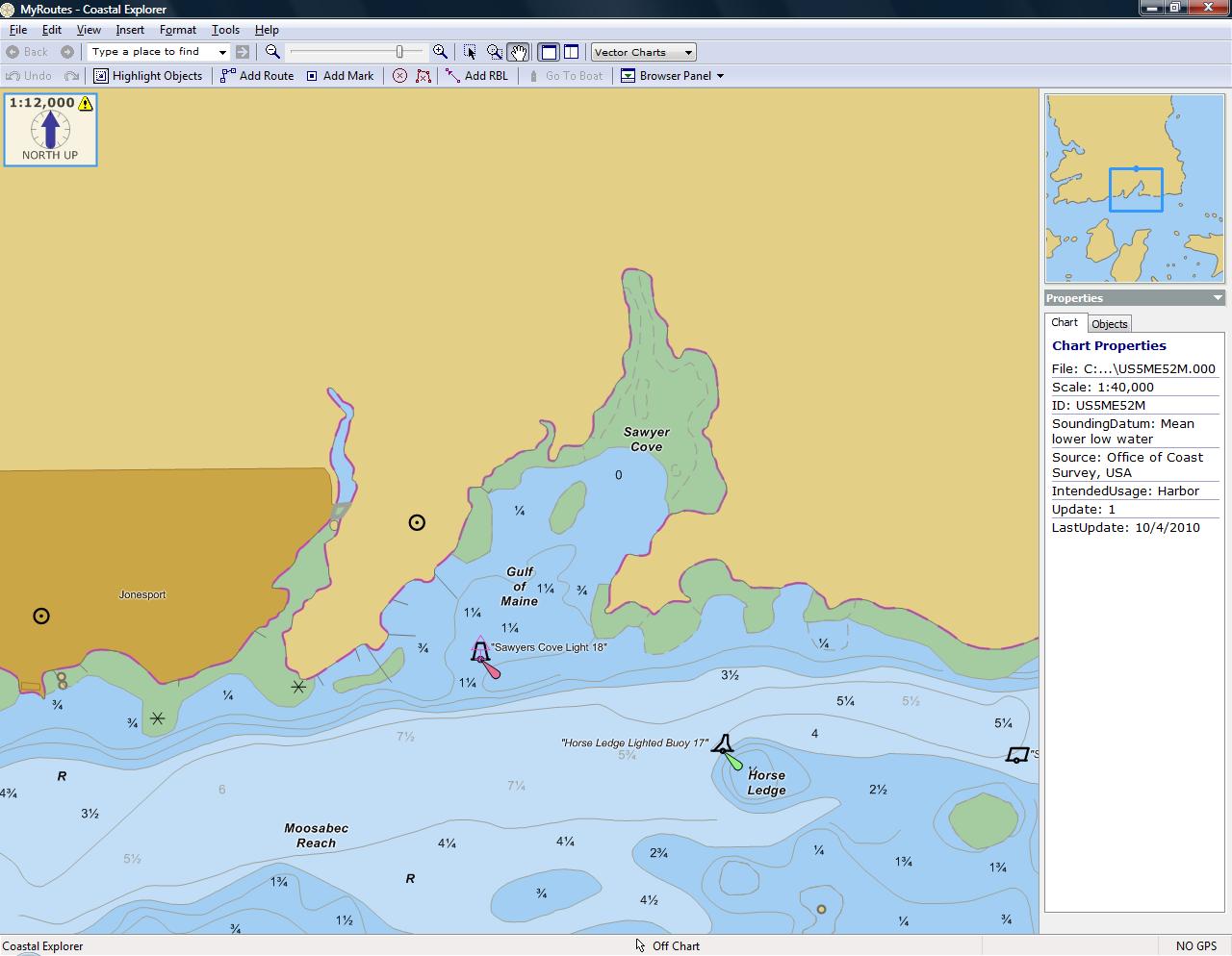
The picture on the left is the Sawyer Cove area in Maine. The chart is the latest NOAA Vector Chart (ENC).
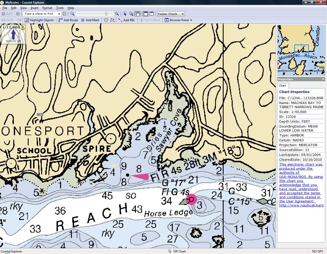
The second picture is of the same area and scaling using the lastest NOAA Raster Chart (RNC).
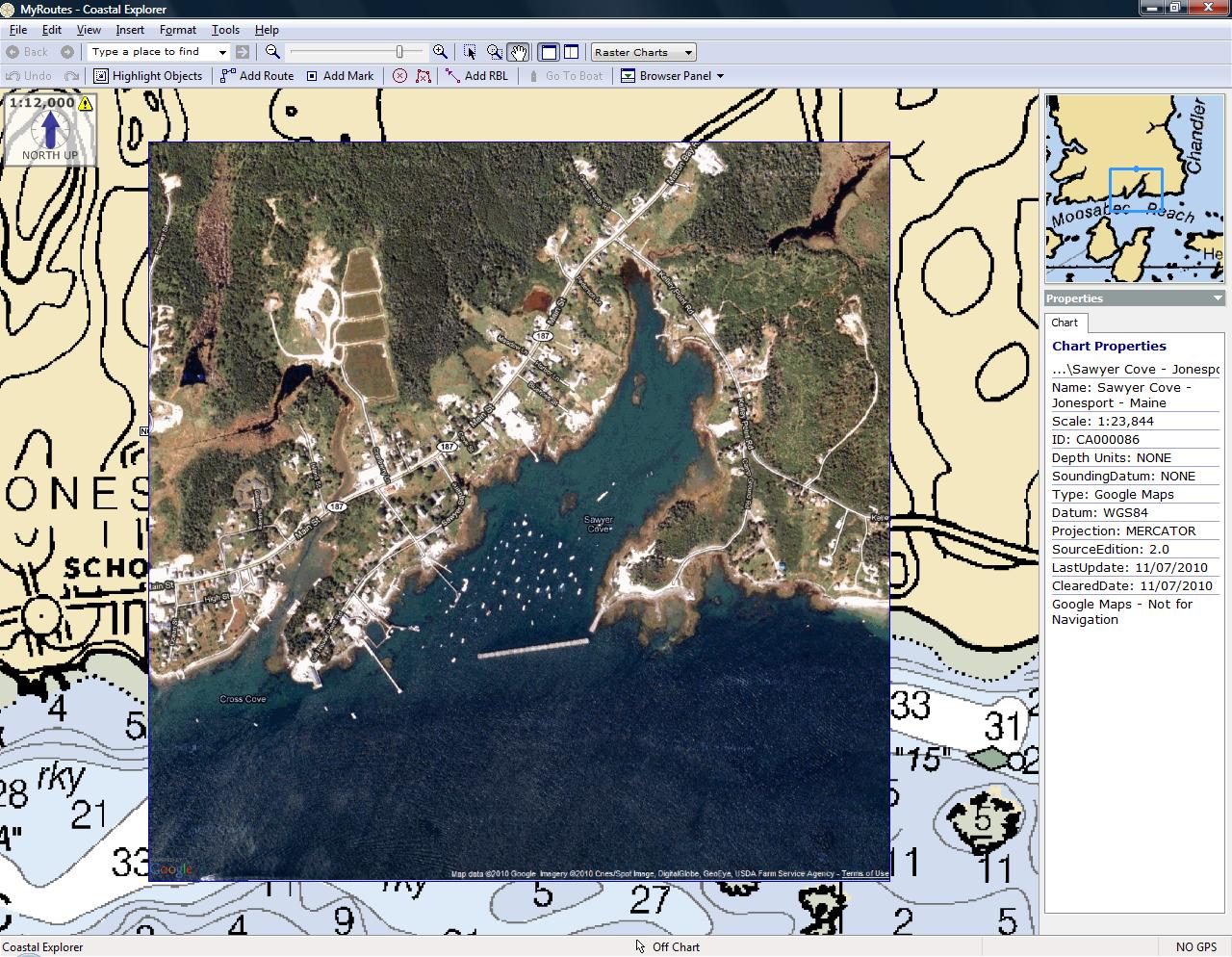
The third picture is of the same area and scale using a ChartAid Chart. Notice that a new breakwater is visible, making the entrance to the bay different. Comparing this picture with the other two illustrates the value of ChartAid.
Home | Previous | Next