11/29/2011
The ChartAid program offers you the ability to save Google Maps, Google Earth, and Microsoft Bing Maps printable images as Raster Charts or Photo Charts to be used with your favorite navigation program:
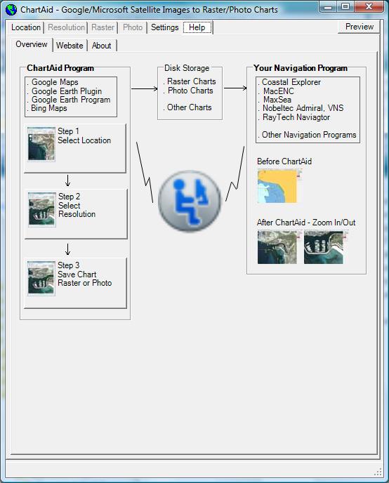
The picture on the left is a screen shot of the Overview Diagram.
The ChartAid program provides an easy to use interface to convert satellite printable images to Raster Charts or Photo Charts. These charts are stored on your hard disk and can then be used with your favorite navigation program.
Charts made using ChartAid have been tested with Coastal Explorer, MacENC, MaxSea, Nobeltec and RayTech Navigator.
Home | Previous | Next