CE - Raster Charts
CE - Photo Charts
CE - All Charts
10/28/2011
If your navigation program supports both Photo Charts and Raster Charts, you may prefer Photo Charts over Raster Charts:
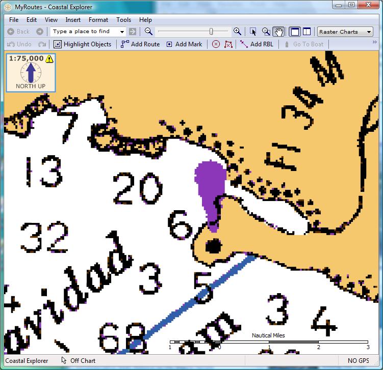
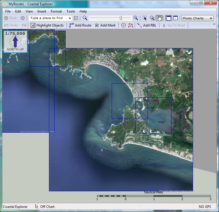
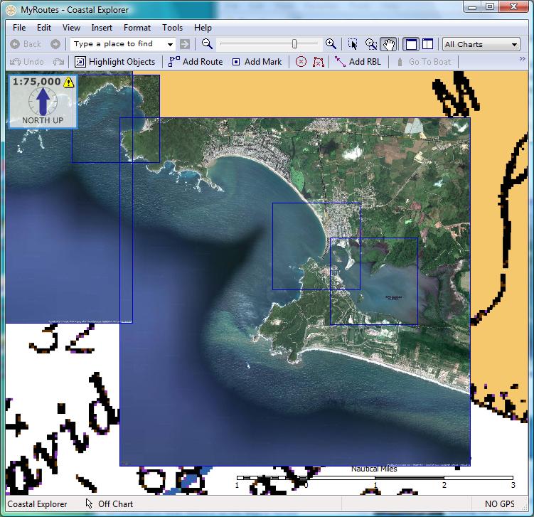
Shown in the example below are screen shots from Coastal Explorer as the user toggled among his original Raster Chart, Photo Charts that he generated, and All Charts that he has available for Navidad Bay, Mexico.
CE - Raster Charts
|
CE - Photo Charts
|
CE - All Charts
|
Also, some navigation programs (for example, Coastal Explorer, Nobeltec and RayTech Navigator) allow you to Overlay Photo Charts on top of other charts. By overlaying the ChartAid Photo Charts, the water depth and notations of the original chart are preserved. This can enhance the presentation and make it easier to visualize the area and still view the usual chart information.
Shown below are two examples. The first example shows screen shots from Nobeltec as the user toggled among his original Passport Vector Chart, a ChartAid Photo Chart that he generated, and the Vector and Photo Overlay for the Dry Tortugas National Park area in Florida Keys.
VNS 9 - Passport Vector Chart
|
VNS 9 - ChartAid Photo Chart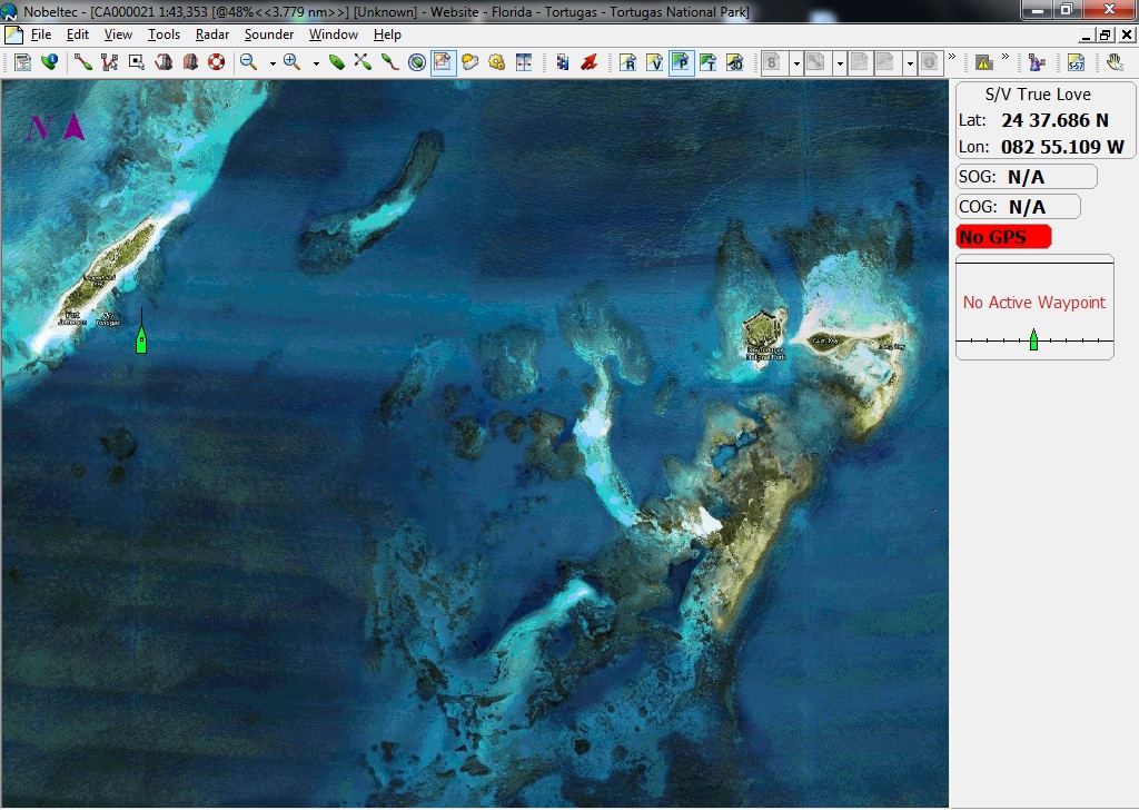
|
VNS 9 - Vector and Photo Overlay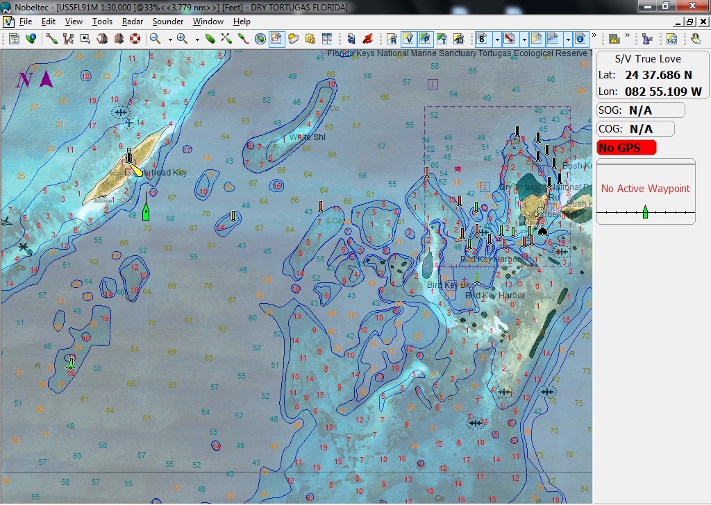
|
The second example shows screen shots from Coastal Explorer as the user toggled among his original SoftChart Raster Chart, a ChartAid Photo Chart that he generated, and the Raster and Photo Overlay for the Costa Baja Marina area in Mexico.
CE - SoftChart Raster Chart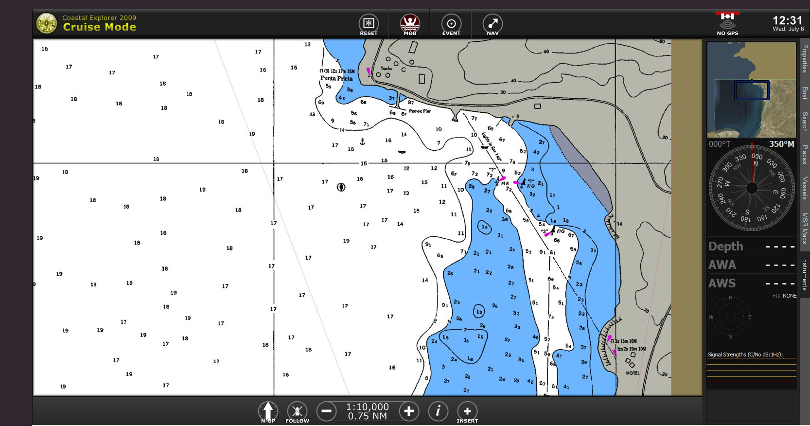
|
CE - ChartAid Photo Chart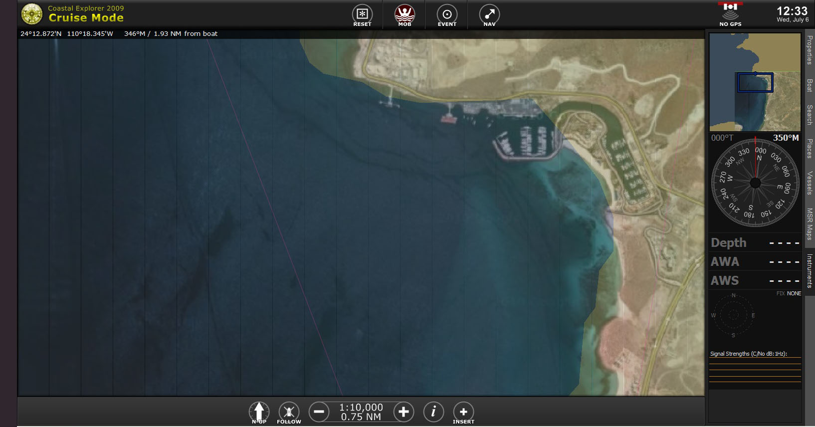
|
CE - Raster and Photo Overlay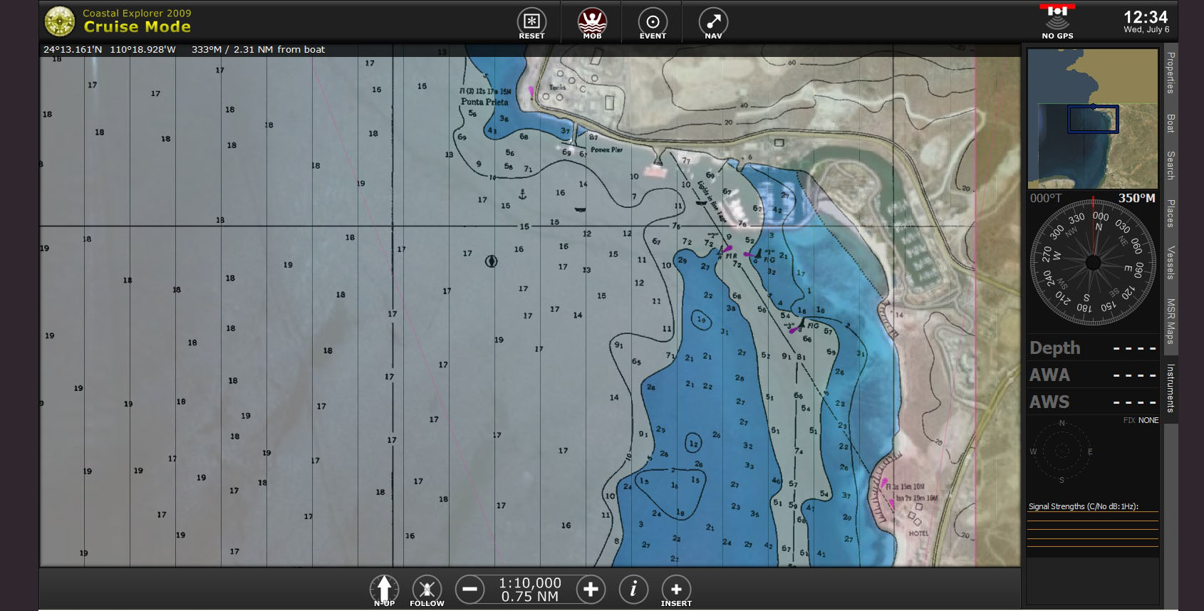
|
Home | Previous | Next